One of New Zealands biggest draw cards for many people is hiking (locally known as tramping). The most famous and scenic are known as great walks: Milford trek, Kepler trek, Abel Tasman or the Northern Circuit are the most popular. Among them Abel Tasman is the only great walk that can be tramped all year round and has plenty of accommodation. The more mountainous treks open only between October and March (dates vary) and beds sell out long in advance.

All fresh and excited to start
These are only some of the reasons why we decided to follow the tracks of the early Dutch explorer. We would have preferred mountain views, but with our volatile travel plans, very changable weather and the increased hut prices (up to NZ$140pp from this year) during peak season made us change our mind. As we also now have camping equipment, we could stay in the cheaper campsites rather than huts.

Sea like the Caribbean, just without the warm temperatures
The Abel Tasman track follows the northern coastline for 60km north-west from Marahau to Wainui. It is possible to kayak or sail all or just parts of the distance and a regular water taxi service allows day walkers to access every part of the route.
We went for the full monty and worked out a plan for three days of walking before returing by boat to Marahau. After one week of camping free or cheaply, The Barn in Marahau was our first proper campsite on the south island with hot showers and other amenities that helped us freshening up and prepare for the adventure.
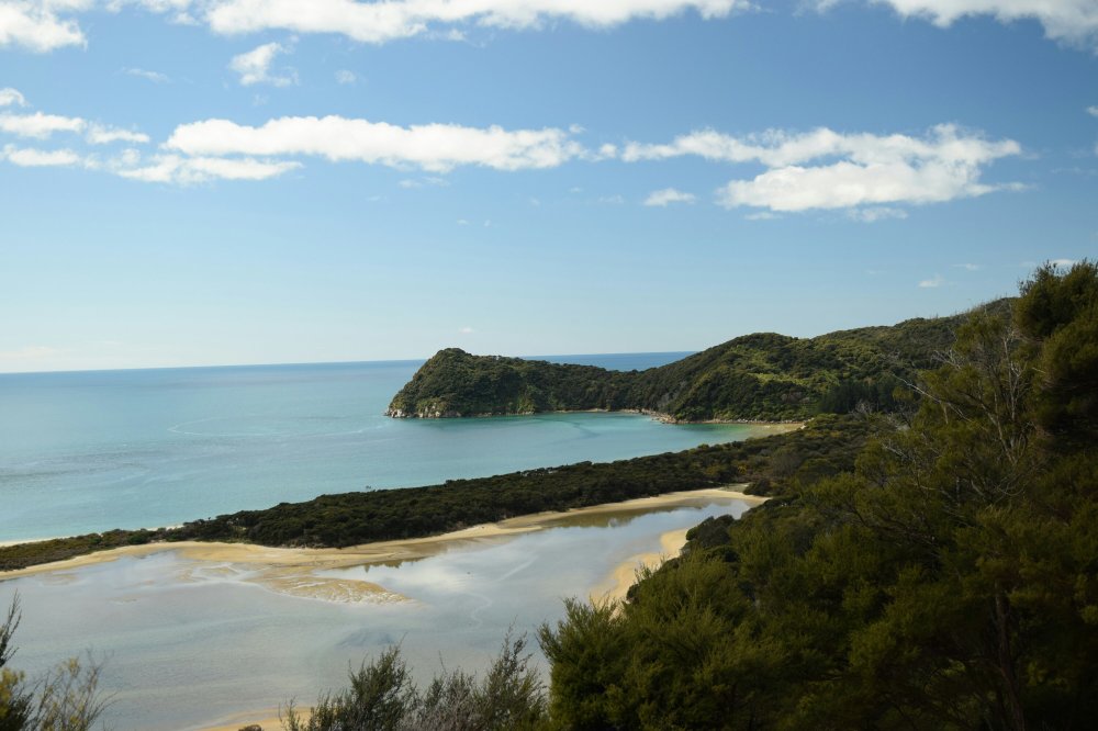
Beautiful views and beaches
After managing to cram the tent, sleeping bags, clothes, food and the stove into our backpacks and strapping the mats outside we were off. The beginning of the walk was pretty flat and easy. Paths were wide and gave us plenty of views. Most of the time we walked among ferns and trees as we followed the coast. We encountered very different types of forest: from light and dry tree-dominated to dark, damp tree fern sections.
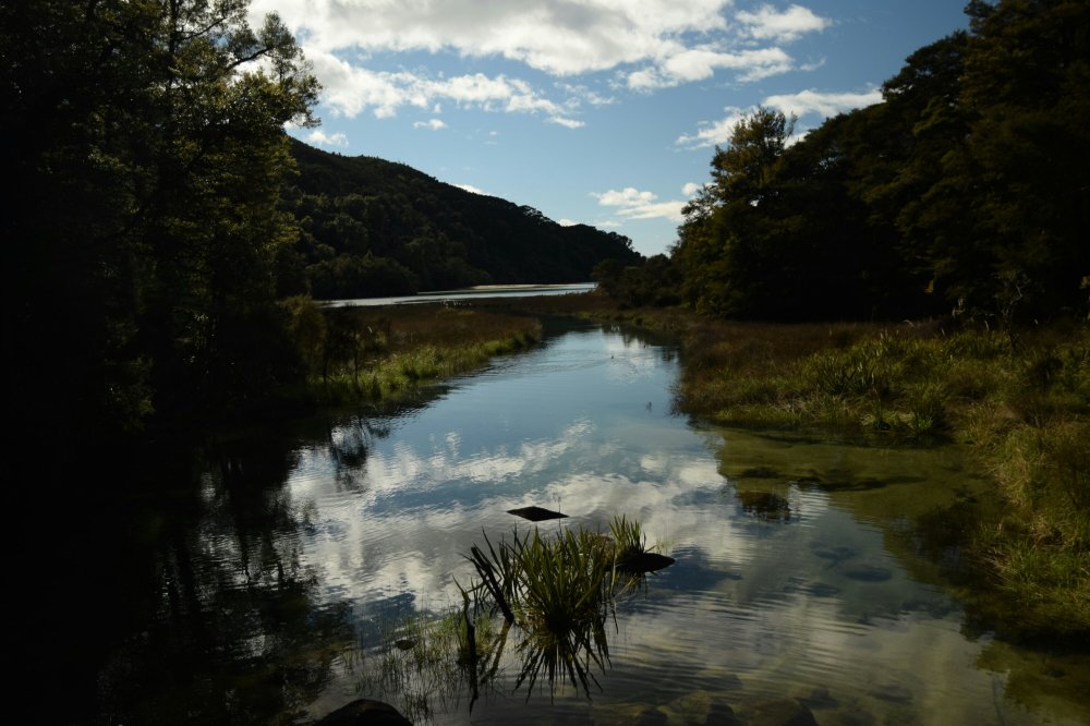
As we made our way along the coast of Abel Tasman National Park forested hills followed sandy beaches. After 11km we reached Torrent Bay. The bay was still full of water and so we had to take the longer high tide route adding about 3km to that days tally. It was also lunch time and we picked Cleopatra pools as lunch spot. The pools are 400m up along Torrent River and really nice. They are like pools at the bottom of water falls and rocky. With a chilly breeze and a river coming from the hills it was way too cold to even dip our feet in. Halfway through our meal Matthias spotted the inhabitant (and probably namesake) of the pool: a long-finned eel.

Behold: the great Cleopatra!
By the time we were back on the main route the bay was dry (apart from the river) and people were crossing it on foot. Even though we had walked a decent distance, it was only half way. Our first camp was in Bark Bay so in total we walked 24km from the car park that day. We were thus quite rightfully tired when we arrived at the camp ground at 4pm. With spaces for 40 tents and a cooking shelter Bark Bay is the second biggest along the track after Totoranui (not counting Marahau at the beginning). Just as we pitched our tent on sand for the first time, a group of young 5 travelers arrived with their kayaks. They came from half of Europe and wanted to do some kayaking and walking in the park.

Bark Bay campsite
We had a lovely evening sitting around a barbeque and chatting before it became to cold and we had to retire to our sleeping bags. Another inhabitant there that night was a weka; a brown flightless bird roughly the size of a chicken. It was constantly looking for food around us and our tents. During the night it also ate half the oats that one of the other travellers had left on a table to soak. Wekas have got a pointy beak and everything apart from plastic boxes and tins is not a problem for these birds.
On our second day we had time in the morning and did not need to rush. We left camp and walked towards Awaroa inlet. Two hills later we met our kayak friends again on Onetahuti beach. We discovered a river half way down the beach that was difficult to cross. Since it was high tide, the water was waist deep and had a strong current. This was quite a surprise to us because none of the info material we read mentioned this crossing. Thankfully our friends did us a favour and ferried us to the other side without us getting wet.

With a little help from my friends…

Like the day before it was really beautiful and warm weather, but with chilly winds, which meant very pleasant walking. That was until we reached Awaroa inlet. The path was meant to go down and follow the beach to Awaroa hut, but instead it climbed up another big hill before dropping down to the hut. We found out that the old path had been closed off because it led through a small settlement of holiday homes and because a few people selfishly did not want to share the bay, everyone had to walk over an extra hill. Also, the DoC had not published this new path anywhere and all the walkers we met at the hut were at least upset about it. The next annoyance was the tide. We knew we would have an hour and a half to wait before the tide was low enough to cross the inlet. The timetable in the hut listed low tide for one hour later than we had prepared for. Somehow the DoC is incapable of publishing the same times on their website and their huts and campsites. At least the sun was shining.

Awaroa inlet can be crossed 2 hours before and after low tide (not 1.5h as listed in some places). You could cross slightly earlier or later, but the river is deeper and you get wetter. Crossing completely dry is definitely not possible, but we crossed water less than knee deep.


Once back in our shoes on the other side the race was on. We had booked Anapai Bay campsite and still 9km to go. Totoranui camp would have been an option, but it is huge and Anapai is way nicer. After stretching our tired legs and ignoring the blisters we managed to get there at 5.30pm (2h from the crossing). Our reward was a completely private campsite (apart from a very persistant weka) and a cold wash/bucket shower. This weka was constantly around us and not scared at all; even when we threw small sticks or sand in its direction. We had to keep an eye on your things at all times to stop it from taking chances.

On our last day we got up really early after a very good night sleep and set off quickly. We had 17km left to complete the trail and return to Totoranui campsite by 2pm for the Aquataxi pick up. On this return section we also climbed over the highest hill: Gibbs Hill at 407m. Zoë had by then accumulated 4 blisters on one foot and we had to walk slower. Matthias carried more of the luggage and we took it easy. The two smaller hills were easy and the gradient up Gibbs Hill was also not too demanding. Another very notable change on the last day was the botanics. Along the flat coast and all over the hill gorse had taken over vast parts of the countryside. While this may be nice to look at while in flower, it is pretty bad news for the biodiversity.


Rain clouds hanging over nearby hills spurred us on and luckily we made it to the campsite without getting hit by more than a few drops.
Three hours of waiting later our boat arrived. We got dry seats in the front which was fantastic because the sea was a bit rough and the boat kept hitting hard into waves splashing lots of water sideways. The driver stopped at two other beaches along the way and after one hour we arrived back in Marahau. A tractor with a trailer came out to meet us and our captain skillfully parked the boat on top of the trailer. We were then pulled out of the water, 200m along the road and onto the car park behind the visitor centre. This was definitely the first time either of us was on a boat being driven along on land.
Instead of travelling on straightaway we went for the convenient option and stayed in The Barn again enjoying hot showers, a proper kitchen, a wood fire and sofas.

Abel Tasman is an awesome trail to walk and only requires moderate fitness levels (depending on whether you camp and how many days you take). It is 60km in total and unless you walk over Gibbs Hill the highest point is 200m above sea level. We loved it, but doing it in three days with camping equipment was about our limit. Apart from our camping gear we carried one set of change clothes, 3 liters of water and food. Dried pasta for dinner was great and light. All huts along the trail as well as Bark Bay and Totoranui campsite have filtered water for drinking which is very convenient and helpful. There is however only one place to buy food which is Awaroa lodge (NOT Awaroa hut) about halfway. Most of the path is over a meter wide and easy to walk. Another advantage of Abel Tasman is that it can be walked all year round. Main season is October to March and it gets really busy then, but at the end of September it was still quiet. We totally recommend this great walk but do your homework and be realistic about your capabilities.


This trip looks amazing !
LikeLiked by 1 person
It was! A beautiful walk and totally worth doing!
LikeLike